Friday, September 25, 2009

Simple Life

asWith a love of rugged coastlines, sandy beaches and cooling sea breezes, it was interesting to muse that the inland landscape is far more picturesque than the coastal in this neck of the woods. On the road again heading down the coast from Karratha to the seaside town of Onslow, the view was flat coastal plains of nothing for miles on end. Not a tree, not a bush, just clumps of grasses struggling to survive amongst a smattering of termite mounds. With no trees to gnaw on, these termites eat the savannah grasses to survive.

Termite Mounds

Onslow, with a population of just 800 people, was a welcomed sight to break up the journey. Shown to our campsite, we were a little perturbed to be situated next to a Bobcat and boat, the latter in a state of disrepair. Scoping out the Caravan Park, it appeared our site was in the slum area, whilst many exclusive water view sites remained empty. Never fear, once they realised what esteemed characters we were, we were moved to prime real estate. Not only did we now have water views, but also a vegetable garden at our disposal, providing us with ripe tomatoes, beans, bok choy, spinach and herbs. A nearby tree was home to many species of little birds, but it was the flock of budgerigars that had us enthralled. Common as a household pet, we still have not got used to hearing their familiar chirp in the wild and seeing them in their natural surroundings.
No longer in its heyday, Onslow is still a quaint little town. However, the most impressive feature was the War Memorial. Only a year old, the memorial has been designed so that the sun, which rises over the ocean, appears through the centre each and every Anzac Day. Looking out across the shimmer over the ocean would certainly add to the sombre reflection of the day.

War Memorial at sunrise

However beautiful the water may have looked, it was once again one that we could not enter. For the past 2 years crocodiles have been spotted here, as they move further south, seeking new territory. With a recent sighting, we opted to visit Old Onslow instead of a swim. Back in 1925, with port facilities affected by silting up of the Ashburton River, the entire town was relocated some 18 kilometres to the east. With most of the buildings and infrastructure moved to the new town site, all that remains of Old Onslow is the cemetery, police quarters and a few brick piles of rubble.

Police Station ruins, Old Onslow

The most intriguing aspect was the piles of old bottles. We know they were ‘old’ due to the type of glass, insignia and bottle design. Why are there so many here? Literally thousands were scattered in piles across the old town site.
Once a thriving pearling town (before Broome), salt is now the major industry of Onslow. Condensing ponds of brilliant white stood out in stark contrast to the red dirt edges. So pure and clean, it was hard to fathom how the contents remained so, the whiteness almost too brilliant to view with sunglasses on.

Salt ponds, Onslow

With such large distances between towns, leaving Onslow we camped under some Ghost Gums by the (dry) Ashburton River on our way to Coral Bay. The afternoon was spent exploring the wide riverbed, chasing emus and collecting firewood to cook a campie dinner. We always have a great sleep when camped out in the bush, the only light the stars in the sky and the only sound the crackle of our campfire.

Ashburton River, Free campsite

Refreshed it was onto Coral Bay. Located on the shores of the Ningaloo Marine Park, Coral Bay has one street and only a handful of shops (with very expensive prices). But, it was for the snorkelling, marine life and white sandy beach (at last) that we were here, and we were certainly not disappointed.
Even though our stay co-incided with one of the busiest Coral Bay tourist seasons, there was no hustle and bustle. The area is still very much untouched- perfect, pristine and protected. The brilliant turquoise coloured water was a tad cooler than we had become used to, but was just too inviting not to enter (I even got in quicker than Dave!!).

Site of original jetty, Coral Bay

With snorkels and masks on, it was then time to submerge into another world, the coral reef a mere 50 metres off the beach. Although the coral did not have the brilliant colours of the Great Barrier Reef, the size and varied specimens soon had us mesmerised. The fish life is abundant, with specimens that we had never seen before- long thin Trumpet Fish, iridescent little blue ones, Angelia Jolie fish (I named such as they had big lips), yellow ones, stripy ones, big ones, small ones, turtles and Eagle Rays. With an effortless motion the Eagle Rays glided past us and although cool to see, I was a relived to see them go- I confess I was a little scared of them (they look evil with their bird like heads and sting ray body). You lose all sense of time and reality in this underwater world, with so much activity, sights and experiences before you. There are no sounds in this world other than the ‘crackle’ of fish eating the coral. It was really weird to witness a Parrot Fish taking large chomps on a piece of coral and actually hearing the bites!

Snapper coming into shore for feeding

Back on land, the fish still entertained us. Large snapper swim to the shoreline at 3.30pm every day for feeding. With half their bodies protruding out of the shallow water, they appear to be trying to walk up the beach. Coral Bay is also home to a Reef Shark nursery, with a natural reef border to protect the bubs from predators and the ocean at large.

Reef sharks in their nursery

The nursery is located only a short walk along the beach and we were soon wading in waters with hundreds of baby sharks.

Thursday, September 17, 2009

The Wild West

Mt Nameless overlooking Tom Price, provides a scenic backdrop to the neat little town. A very steep track leads you to the top and having held my breath on the way up, was rewarded with a view of mountains and valleys that seemed to go on forever. From here the countryside took on a new ambience with touches of green and a smattering of well fed trees. The ever present iron ore rocks were still abundant, capping the mountain tops and producing a terraced effect down the mountain side.


View from atop Mt Nameless and Bearded Dragon, red from the dirt

Hamersley Gorge lies at the less frequented southern end of Karijini National Park, and made a pleasant stop on our way to our next camp. The gorge ends in a deep pool, or you can swim further up the waterfall in the ‘spa’.


Hamersley Gorge


However, it was the swirls and patterns of the gorge rocks that was the most impressive feature. Looking like ancient aboriginal art, we had to remind ourselves this was a pattern carved by nature over many millions of years.


Millstream-Chichester National Park aquifer

Millstream-Chichester National Park, our camp for the next few nights, is an oasis in the middle of this dry Pilbara country. An aquifer, or underground water reserve, feeds constant water into the Millstream wetland. With over 1,700 million cubic metres of water in reserve, there is certainly plenty of water to splash around in. A pastoral station once occupied the park, and was in operation for more than a 100 years.

The old stone homestead is now the visitors centre, (as shown below).


Fortescue River, which doubled as our bath..... Millstream-Chichester National Park


However, the 200,000 hectare national park is also home to the traditional Pilbara landscape of rolling Spinifex hills and spectacular escarpments. As a consequence you get a real diversity of both arid and wetland plants and animals. We have never seen paperbark trees as big as here, which are known as Cadjabut. They provided welcomed shade from the sun. Is it because there is so much iron ore in the ground, that it seems to heats up like metal making it is so hot out here? The nights were fortunately cooler and allowed us to sleep comfortably listening to the sounds of nature- we are still not sure if it was a quoll or feral cat we could hear.

A blue haze seemed to envelop the landscape, dulling the scenery as if it was a watercolour painting. This is not to say that it made the view bland, but rather the opposite. Walk to any lookout and you marvelled at the subtle shades of the watercolour in front of you. It was really an amazing sight to behold. We were viewing a living, breathing painting, much like an Albert Namitajira. (Infact, this region is more unexplored than Central Australia). With the big, wide Fortescue River such an odd sight after so many dried up river beds and the best value camping to date, Millstream-Chichester National Park is one of our favourite parks.

As we journeyed towards Karratha, we stopped in at the Python Pool, located at the other end of the park. The pool is nothing to write home about, but by jingo the views on the way out are simply awe inspiring (and I hate to use the cliché scenery verbage). Sweeping valleys are framed by plateau topped mountains, such an unusual sight in Australia. The landscape is more

Python Pool and 'Wild West' view

reminiscent of the America in Wild West movies. Stopping to soak up the view, we were half expecting John Wayne to come riding by, followed by half a dozen Sioux Indians. Alas, we were the only ones out here, with only our imaginations for company.


Aboriginal petroglyphs in the 'red rocks' photo below


All good views must come to an end, and so it was on to Karratha. Known primarily for its resource industries- iron ore, natural gas and salt, it is also the only major town for literally thousands of kilometres (it has two supermarkets!). Red rocks dominate the journey into town. I look forward to the day when we escape the ‘red’. It seems to penetrate every fibre of clothing and has turned our white car a lovely shade of pink (hence the saying- Pilbara pink). It even seems to penetrate the skin, giving us a fake tan effect- perhaps there is a market there? A short drive from town is the Burrup Peninsula and a day’s exploring led us to untouched scenery (including red rocks) and aboriginal petroglyphs (rock engravings). There are over 10,000 individual engravings in the area and is one of the most prolific art sites in Australia. With about a trillion rocks in this area, it is no wonder so much art abounds. With the North West Shelf Oil and Gas venture a huge part of WA, we took ourselves off to learn more.

Overlooking the gas plant the visitors centre explains the origins of oil and gas, through to the recovery, processing and transformation of energy. Not to mention the importance to the Australian economy. The North West Shelf is capable of producing 16.3 million tonnes of natural gas a year. The mind boggles at just how much is lying beneath the sea.


North West Shelf Gas Plant, Karratha

Old gaol, Roebourne

Karratha 
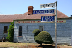
was established in the 1960’s, however is surrounded by historic towns. Roebourne, 30 kilometres east, has many old stone buildings, a reminder of the early days. The town dates back to 1866 and is the oldest Pilbara town still in existence, with the old gaol having been made into a museum. Displays show what life was like for the first European settlers and the harsh treatment of local aborigines. Many were blackbirded- basically rounded up as slave labour under brutal conditions.

Cossack, not far from Roebourne, was the districts main port until the late 19th century. Point Samson took over as the main port once silting tides became a hazard. The town was then abandoned and today relics of a former grandeous time remain. A few buildings on the main street have been restored. Outer streets are now home to ruins, as nature once again reclaims what was hers.


Remaining buildings in the abandonded town of Cossack and the Courthouse in the main street

Friday, September 11, 2009

Itchy & Scratchy

Port Hedland. Australia’s biggest port by tonnage and infact one of the biggest in the world. As you drive into Port Hedland large scale construction and stock piles of iron ore and salt dominate the skyline. Yet the main street is only about 100 metres long. The sun beats down with an intensity we had not experienced elsewhere. This is possibly due to the lack of trees and flat open spaces reflecting the heat. However, there is serious money to be made here, for those who wish to brave the harsh Pilbara summer. Temperatures reach 49 degrees and the only respite is inside your air conditioned home with the blinds closed. BHP is currently looking to employ unskilled workers and at a starting salary of $105,000 it is tempting. Lucky they also subsidise your rent, as a modest townhouse goes for $800 per week!
With mining such a huge part of this town, we joined the BHP iron ore plant tour, and learnt how with about $7 billion we could start our own plant- the process is fairly basic. Iron Ore is not the only commodity to pass through town. Amongst other metals, salt is also produced and exported. Tthe Asian market is the main customer for ‘Dampier Salt’, which is used in plastics.

Big machines, big piles of iron ore, BHP Mine tour

Supplying 34% of the world’s iron ore, it is a busy harbour. Watching tugs navigate ships in and out of the port, mostly bound for Asia, you get an idea of how big an industry this is. Out to sea huge ships are lined up waiting for high tide to allow ease of entry and to have their fill of iron ore.
With the tides varying by metres, we got the opportunity to once again witness the ‘Staircase to the Moon’ phenomenon. As the moon rose, rays of moonlight hit the pools of water left by the receding tide, and created the illusion of a staircase to the moon. The moon rising is in itself a pretty picture and we sat on the beach at Cooke Point, watching the show before us.

Moon rising, Staircase to the moon, Port Hedland

Having been attacked by midgies (sandflies) and suffering the resulting, relentless itchiness we headed inland, away from the mangroves of the coast. Heading out of town the countryside was desolate. The red, dusty plains sparse, save a few tufts of Spinifex and many, many dead cows. We passed the turn off to the town of Wittenoom. In its heyday in the 1950’s Wittenoom was the region’s biggest mining town. Blue asbestos was mined here- the most deadly form. It was not until hundreds of workers started dying of lung cancer that the mine was closed. However, can you believe they knew of the dangers back in the 1920’s, but were told to keep quiet!!! Since 1979 the West Australian government has tried to shut Wittenoom down. Empty buildings have been bulldozed; the water supply has been cut off, as has the power recently. However, some long term residents refuse to leave- they are dying anyway. Curious tourists are told to keep all windows closed to avoid inhaling the asbestos fibres, potentially stirred by the movement of your car. We were certainly curious but opted to stay well away, the fibres are too small to be seen, but it only takes a small amount to produce a slow, painful death up to 40 years later.
Instead we amused ourselves by listening to Dracula (having downloaded some audio books), until the vista finally got a little more mountainous. A hint of wildflowers began to poke out from the rocky ground- something pretty in this harsh Pilbara country and a taste of what we are to see in abundance down south. As we drove up and down over the mountains, the Spinifex tufts were still present and dotted the slopes looking like fluffy pom poms.
We were now in the Hamersley Range, in the heart of the Pilbara, and home to Karijini National Park. Massive mountains and escarpments rise out of the valleys, dissected by gorges.

Circular Pool, Dales Gorge, Karijini NP

We have seen many, many gorges however Karijini is home to some of the most spectacular and unique specimens. Gorge walks protected from the beating sun above, end at a rock pool for a cool swim, or shower under the cascading waterfall. However, be sure to check for the presence of blue, green algae during the dry season.
We camped at Dales Gorge, near Fortescue Falls, a popular place to swim. We did notice some algae on the surrounding rocks, but this is common in fresh water pools and many other people where cooling off here. However, this was blue green algae and resulted in rashes and itchiness worse than our midgie bites. We were also plagued with hay fever type symptoms, nausea, hot and cold flushes and a general unwell feeling.

Leisa at Fortescue Falls, Karijini NP

Further on from Fortescue Falls a path through huge paperbarks and fig trees led us to Fern Pool. Flowing year round the pool is filled with clear fresh water and no algae. We managed to wash ourselves, but the damage had been done.

Fern Pool, Karijini NP

The walks to most of the other gorges are a harder grade and we were not feeling the best, but lookouts provided some of the most amazing views we have seen to date. Oxer Lookout, the parks signature attraction, makes you gasp at the sheer beauty and size. This is where four of the gorges- the Red, Weano, Joffre and Handcock meet, having been created when forces split apart the rocky terrain some 2,500 million years ago.

Oxer Lookout, Karijini NP

We certainly enjoyed our time at Karijini, with some of WA’s most spectacular sights, and enjoyed getting back into the swing of bushwalking once more. However, the blue green algae made us not feel the best, so it was off to Tom Price, for some recuperation.


Knox Gorge, Karijini NP

Another mining town, Tom Price is the highest town in Western Australia at 747 metres above sea level.

Big toys at the Rio Tinto Mine, Tom Price

We took the opportunity to tour the Rio Tinto mine, one of the biggest in the world, to view the iron ore process before it makes it way to port, bound for Asia.

'Big Bucket' Mine tour, Tom Price


Overview of Tom Price process

Friday, September 4, 2009

No place like home

September 3 marked the official ‘one year on the road’ for us. We have no plans to stop anytime soon, but feel we will end up back in Sydney when we settle down. In aboriginal lore the place where you were born is where your spirit lives- a sacred dreaming place. It is a place of belonging, of being one with the land. A place where knowledge, peace and happiness is found. Dreaming sites are found all over aboriginal Australia exerting a pull on the spirit and soul, always to return to the heart of ones dreaming. And besides, we are yet to find a beach that competes with the ones from home.........

Our campsite, Barn Hill Station

Heading south from Broome, Port Hedland, the nearest town is over 680 kilometres away. So it was once again a time of red dirt and the outback. However, this time it was the outback on the coast. Our journey scooted the edge of the Great Sandy Desert, so it was no wonder the landscape reflected such. Anorexic looking trees, with their ravaged limbs struggled to survive until finally petering out. The road then simply divided a vast nothingness, bar spindly grass. Outback cattle stations eke out a living in this harsh land and to supplement their income, many have set up a caravan park on part of the station.

Barn Hill Station even has a Bowling Green...

Our first night when we (finally) left Broome was at Barn Hill Station. Camped on the cliff top we had a view of the Indian Ocean, which also provided some cool relief. If you are ever in this neck of the woods, make sure you stay here on a Sunday night. This is when some country entertainment is supplied and makes for a fun night.

Certainly is a big country, we would have travelled all of Europe by now

Australia is one big country, so it stands to reason that her beaches stretch forever. Eighty Mile Beach (which is actually 110 miles, 176 kilometres) was one of our favourite spots. An aquamarine ocean literally dumps thousands of exotic shells on the shore. Beachcombing one afternoon a pod of dolphins seemed to follow us as we made our way down the beach. The wildlife out here really is prolific.

It is a popular spot, but the red dirt road in to the Caravan Park is in good condition.

Don't leave the gas on.......

It was surprising then to see a burnt out caravan abandoned on this road. We learnt that only a week prior some poor grey nomads had had the fright of their lives. Gas cylinders inside their van had exploded and caught fire. The burnt out carcass will remain until inspected by insurance officers, but also provides a reminder to turn off the gas before travelling.

Low tide, Eighty Mile Beach, so far from the shore, but still no water!


Eighty Mile Beach, high tide

We will never tire of the jewelled colour of the ocean over here. However, with tides that vary from 7 to 10 metres, the walk out to the ocean can be a long one at low tide. It really is a strange phenomenon, when the ocean recedes you are left with a big tidal flat. Crabs, small fish, octopus and sea cucumbers are left behind in the shallow pools, so you have to be careful where you step.

Crabs fighting, Eighty Mile Beach


Cape Keraudren, was our final stop before Port Hedland. With a bay on one side and the ocean on the other, we soaked up the beauty. The water was so clear that we could clearly see turtles swimming deep underwater. However, it was the kangaroos that provided the best experience. They are obviously used to campers, for when I called over ‘Skippy’ from 100 metres away, I got the shock of my life when she actually bounded over to me! We had to quickly move our herb garden inside, but she seemed content to forage near our camp.

Me and my friend Skip

The next morning she was back and wanting to join us in our camper. Sorry Skip, the spare bed is not available for you.
Cape Keraudren is also where the Rabbit Proof Fence ended, however no longer stands. No fences are now in sight, just a pristine wilderness, midges (sandflies) and very friendly kangaroos.

Cape Keraudren